|
||||||||
|
||||||||
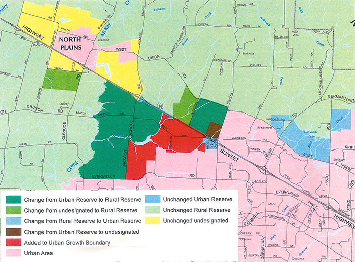
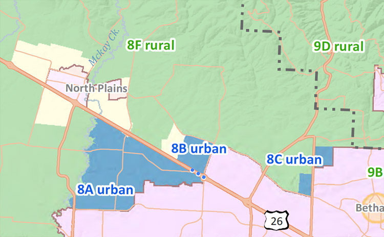
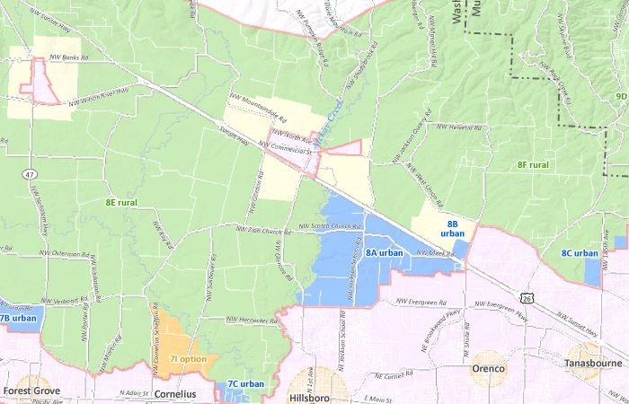
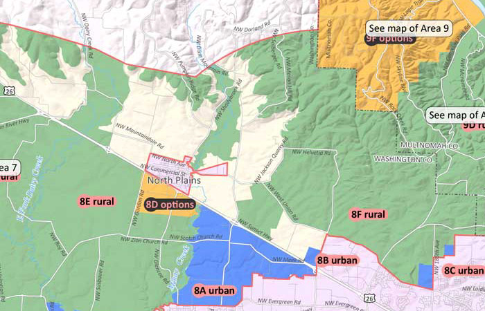
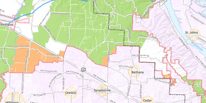
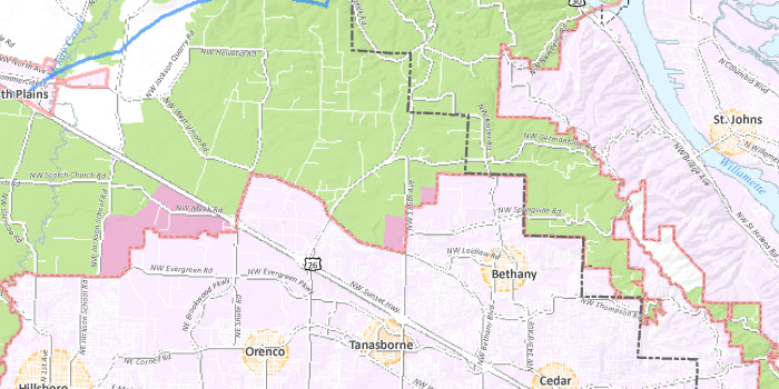
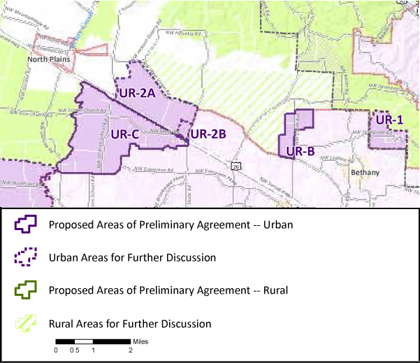
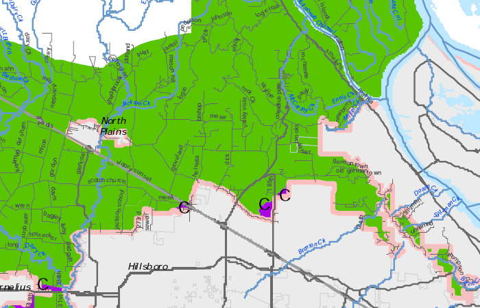
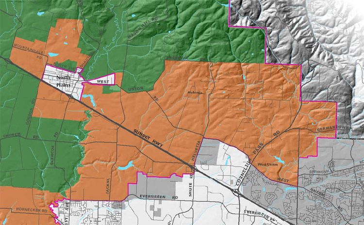
HB 4078 - The 2014 Legislative "Grand Bargain"Map showing designations specified by the "Grand Bargain" of HB 4078. Reserves approved by LCDC on August 19, 2011The map below shows a section of the map of Washington County reserve areas that was affirmed by LCDC on August 19, 2011. 2011 Metro UGB expansion - COO recommendationThe map below shows a section of the UGB expansion areas recommended by Metro's COO on July 5, 2011. 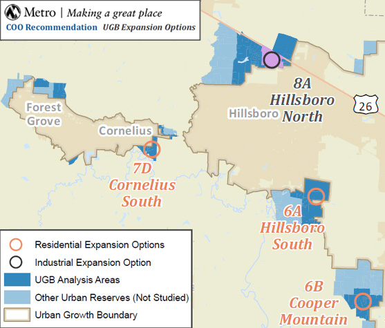 COO recommendations for 2011 UGB expansion (7/5/2011) WaCo December 2010 proposalThe map below shows a section of the map of Washington County reserve areas that was approved by the WaCo Board of Commissioners on December 14, 2010. The map was proposed in response to the DLCD remand of the Reserves specified in the IGA approved in March of 2010. 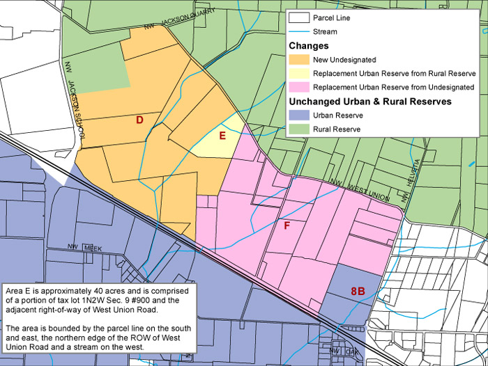 Proposed Urban and Rural Reserves in Washington County (12/14/2010) See also: full map of the county (PDF, 485KB) Metro UGB search toolWondering whether a specific piece of property is inside the UGB? Or whether it's in an urban or rural reserve? Metro has a new UGB lookup tool you can use. Just enter an address and all will be revealed! Metro Annexation search toolHave you ever tried to figure out the history of a home in your neighborhood, or need to know boundaries of various planning districts? If so, you've probably spent time looking at annexation records, mostly in print and only at a local agency like Metro. Good news – Metro has a new annexation search tool you can use. Just enter some identifying information and all will be revealed! Metro reserve areasThe map below shows a section of the map of reserve areas in Washington County that was released on 2/18/2010. 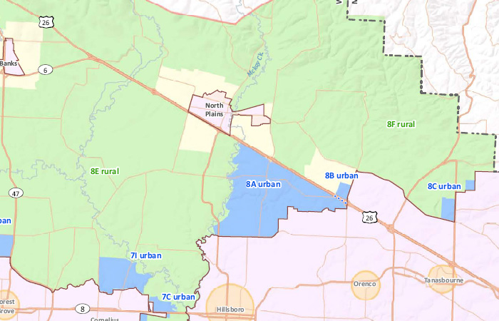 Urban and Rural Reserves in Washington County (2/18/2010) See also: full map of the county (PDF, 1.5MB) The map below shows the Core 4 proposal for reserve areas in the vicinity of Highway 26 that was adopted on 2/8/2010. The orange areas indicate areas for further discussion. The map below shows a portion of "Area 8" of the 12/16/2009 Core 4 proposal. The new numbering system is being used in the on-line survey that runs from January 11-22. The map below shows the Core 4 proposal for reserve areas north of Highway 26 that was adopted on 12/16/2009, and which is to be used as the basis for public comment during January. The dotted lines indicate areas for further discussion. 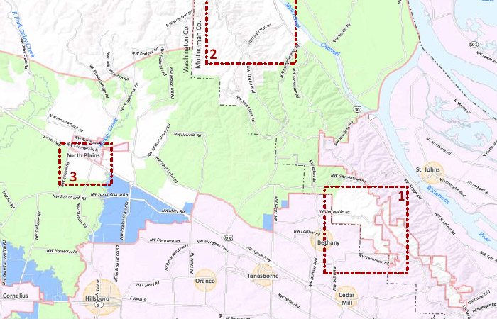 Core 4 Urban and Rural Reserve Proposal for Public Comment (12/16/2009) See also: full map of the region (PDF, 1.4MB)
The first proposal, put forth by David Bragdon and Carl Hosticka, designates 28,610 acres of urban reserves,
10,169 of which are Foundation farm lands in Washington County.
This proposal was approved by the Council.
We were disappointed to see that Councilors Kathryn Harrington and
Carlotta Collette voted to accept this proposal,
which designates about 10,000 more acres of urban reserves across the Metro area.
The second proposal, put forth by Robert Liberty and Rod Park, designates 18,742 acres of urban reserves,
5,073 of which are Foundation farm lands in Washington County (less than half of the Bragdon/Hosticka proposal).
Note that this proposal designates all lands north of Highway 26 as Rural Reserves, as well as significant areas to the south of Highway 26!
Ag/Natural Resources Coalition (ANRC) proposal
The map below shows the ANRC proposal for reserve areas north of Highway 26 that was released at their press conference on 1/11/2010.
For more information about the ANRC, please see this page. Farm Bureau proposal
This map was presented by the Washington County Farm Bureau to the Board of Commissioners on 12/15/2009.
The image below is a subset of the map showing the areas around Highway 26. 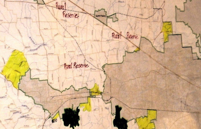 Photo of Washington County Farm Bureau map courtesy of Nick Christensen of the Hillsboro Argus. See also: full map of the region (JPG, 274KB) Reserve candidate areasAugust 3, 2009 proposalThis map shows the Urban and Rural Reserve candidate areas north of Highway 26 proposed by Washington and Multnomah County as of August 3, 2009. Note that there are many other candidate areas south of Highway 26 and across the Metro region.
This is an interactive map; you can pan and zoom the map to see areas of particular interest to you. If you zoom in closely you will see street names. Markers on the map indicate points of interest in the area. Note: This map was created by visual inspection of Washington County and Metro maps. Its accuracy is not guaranteed. Please contact Washington or Multnomah County for official information. Source: "Recommended Rural and Urban Reserves (draft)", dated August 3, 2009, distributed by Washington County. See page 3. May 7, 2009 proposalThis map shows the Urban and Rural Reserve candidate areas north of Highway 26 proposed by Washington County on May 7, 2009.
 Source: "Staff Recommendations for Candidate Urban Reserves Adjustment", dated May 7, 2009, distributed by Washington County. |
||||||||
|
Home • About us • Recent news • What you can do • Donate |
||||||||
| Reserves process • Making our case • Maps & resources • Contact us | ||||||||
|
Web site design and programming by Brian Beinlich • Contact the webmaster |